I plan to leave Dawson City around noon, taking the ferry across the Yukon to head towards Alaska. In the morning we have two more things to see in Dawson. It rained pretty hard last night and everything is still very wet. I still have to pump out the holding tanks and fill the water tank. With 20-20 hindsight I should have done that last evening, but was too lazy.
 |
| Dawson City |
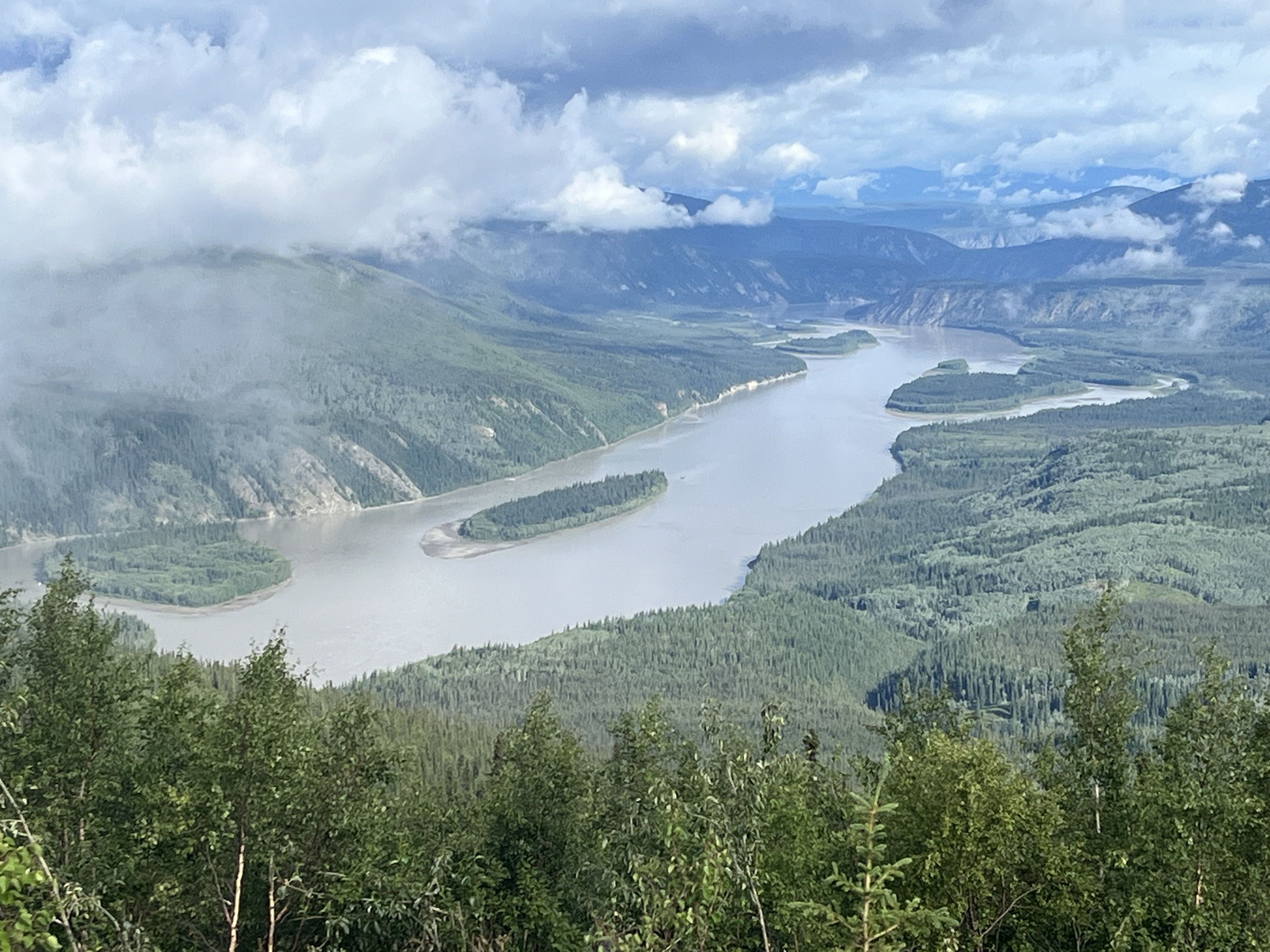 |
| Yukon river flowing north to the Bering Sea |
The first thing I wanted to do was to drive up to the “Dome”, a mountain top with a view of Dawson City and the Yukon River. There are still low clouds and the “Dome” is in the clouds, but I hope it will clear as we drive up. The view is somewhat obscured when we arrive but gradually starts to clear as we walk around. We get talking with two motorcyclists from Texas that plan to ride to Prudhoe Bay. A tough ride in a 4 wheel drive vehicle, even tougher on a bike with trucks blowing by you. One of the fellows shows me near live pictures of Hurricane Beryl overflowing his swimming pool back in Huston. His wife has lost power and is not happy he is off heading to Alaska. It finally clears and we get some fabulous views.
We head back down to Dawson to our second stop, The Dawson City Museum. We leave there and gas up. Driving back through town we see that the bakery is open and stop in. We should have been here 3 hours ago, not much left, we get a scone and a sticky bun and order a sandwich to go. Seeing the empty bins and the labels, it probably is a good thing we arrived late, saved us a mess of calories.
 |
| Dawson city Museum |
We drive down to the ferry which is run by the government. It runs 24/7 and is free. Runs from mid-May to mid-October. Most winters the government maintains an Ice Road across the river. When they put a closed sign up prior to ice out in the Spring the locals still drive across, pushing their luck. There are a number of residents who live on the other side of the river. During freeze up and ice out they have to find a bed in town if they have a job there or stock up on food for a month or two.
We are lucky, must be a slow tourist day. We are the first vehicle in line and the ferry is currently on the other shore. I am told the wait can be a couple hours at times. The ferry can hold maybe 8 cars, but RV’s, trailers, 5th wheels take up a lot of space, slowing the process down. There is at least a 5 mile anhour current here and it makes for an interesting crossing.
 |
| Ferry coming in |
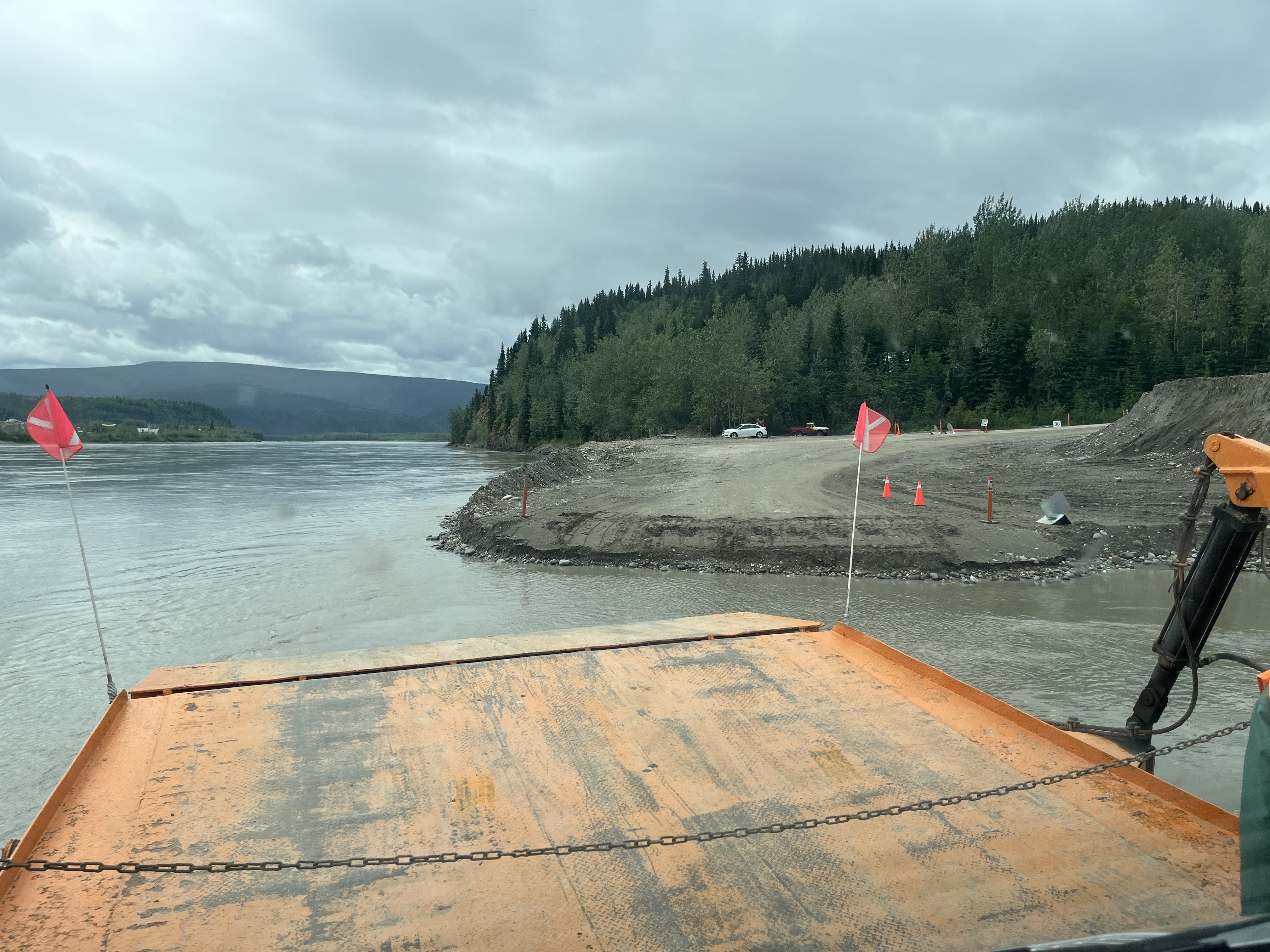 |
| Ferry dropping us off, kind of like a landing craft dropping us at the beach |
One of my RV apps shows a couple very interesting free boondocking sights on the far end of the Top of the World highway. We stop at one of them for the night about 20 minutes east of the border with Alaska. We parked at the highest point on the highway above the tree line with fabulous 360 degree views. Herds of Caribou do wander through above the tree line tundra here, so we are hoping to get lucky and see some tonight or tomorrow morning as we head to Alaska. Our first stop after Customs is the town of “Chicken” and then on to “Tok”.
 |
| Parked for the night |
Sunset is now around Midnight. I was hoping for clear skies tonight, being high up with a clear view to the western horizon. We have had rain and sun today, but now at 10:00PM, as I write this, it is cloudy so you can’t really discern sunset, its just a long gradual slide into dusk and twilight. Even down in the valley in Dawson City it doesn’t get fully dark at the maximum around 2:00AM. Sunrise is around 4:00AM. On the other hand it does make it easier to go to sleep. When the sky is clear you have no idea how late it really is
No comments:
Post a Comment